Multi-Multi-Hyper Created by Tamme on 3/18/2019 2:44:33 PM Remote Sensing has gone through an enormous transition in recent years: Copernicus - the European Earth observation program - delivers high quality data with high frequency and as open data. Especially the optical data of the Sentinel-2 satellite is a game changer with many applications that have been conceived in 40 years of Remote Sensing (finally) become reality.
Sentinel-2 provides information in 12 different spectral bands, the most important of which with 10 meters ground resolution and some specific bands with 20 and 60 meters resolution. This provides all kinds of new possibilities for monitoring the earth's surface, especially for vegetation monitoring for agriculture, forestry or water management. But strangely enough, after 3 years of Sentinel-2, the 40-year-old NDVI is still the most widely used vegetation index. The NDVI shows the ratio between the reflections in red and infrared, and was 'earlier' very popular, because satellites had few spectral bands. Information from other bands can provide very specific information such as a water (stress) index or a chlorophyll index (nitrogen content in the plant). Also, there are now also drones - actually self-controlled satellites - that contain cameras with many spectral bands, the so-called hyperspectral cameras.
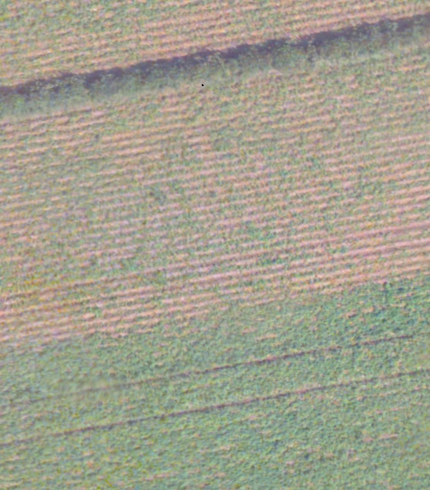
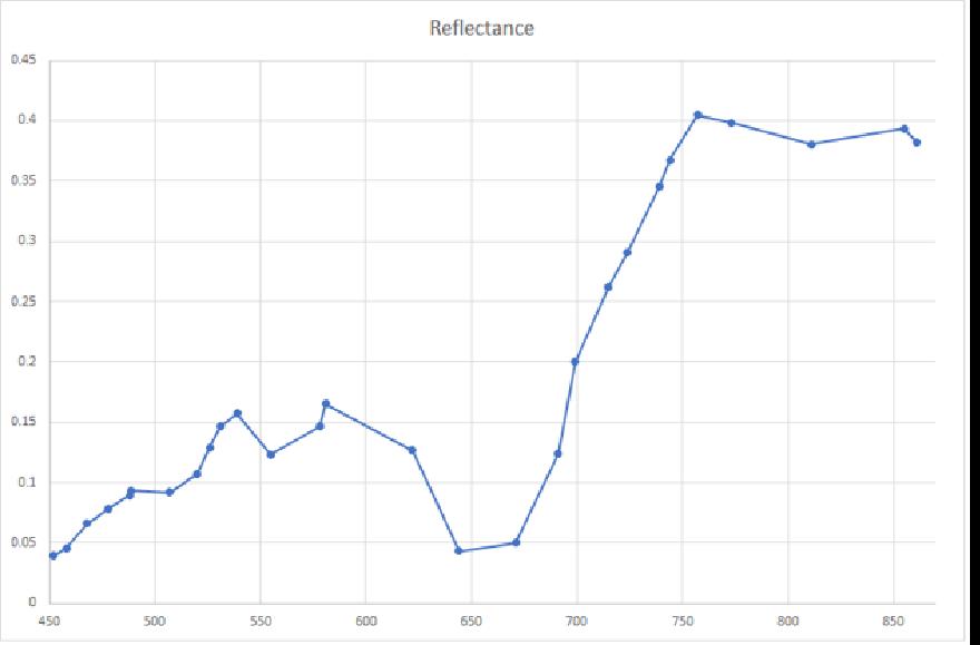
Image 1: A drone image of a potato field with clear differences in emergence between zones above and below. Right: Reflection curve of a potato plant as recorded with a hyperspectral camera. The blue bands in the background represent the wavelengths of the Sentinel-2 sensor.
In several projects AeroVision works on fulfilling user requirements with these new bands and sensors. We provide the Remote Sensing knowledge for a monitoring project of date palms. In this project we analysed the hyperspectral drone images and drew conclusions regarding the technical feasibility. We are also collaborating in a network in which 12 young scientists detect all kinds of plant characteristics with hyperspectral remote sensing. And we evaluate the possibilities of hyperspectral sensors for determining soil quality.
The role of AeroVision is to connect the requirements for use with the wider technical possibilities: the big change is that Remote Sensing is no longer about a satellite or aerial photo, but about integrating multi-temporal, multi-platform, multi-scale and multi-spectral. The work field changes from classification and object detection to monitoring and signalling of deviations. With these projects we are leading the way in discovering these new data sources and in their integration in data cubes or cloud portals. The world of Remote Sensing is changing, and we are changing with it.
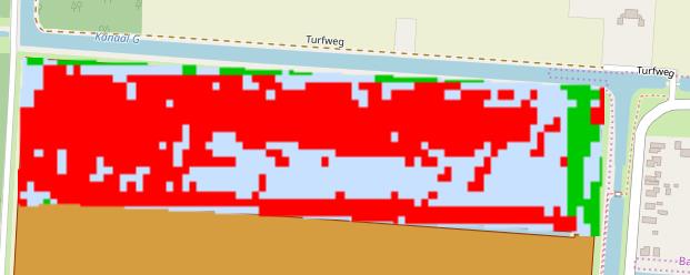
Image 2: By monitoring a crop throughout the growing season, differences in growth can be better analysed. This map shows the average growth (blue pixels), the places with growth lagging behind (red) and above average growth (green).
