
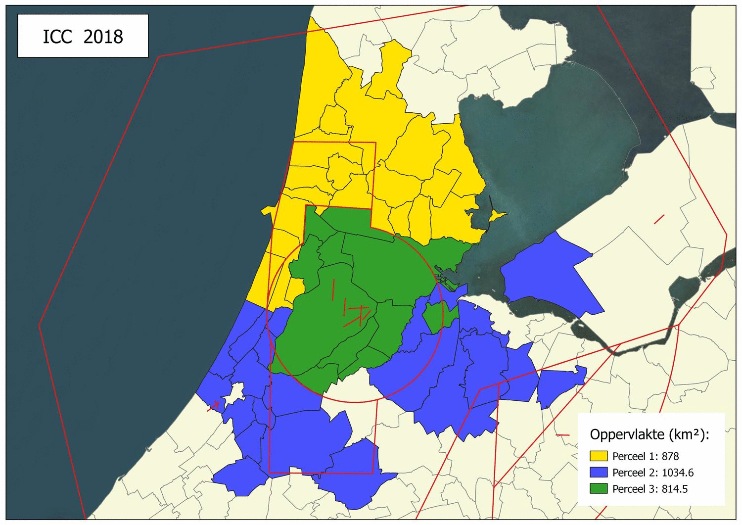
The Information & Coordination Centre 'Regio Schiphol Bevlogen' (ICC) was established for (semi)governments and government affiliated organisations in the Schiphol region in order to have access to up-to-date aerial photographs and other remote sensing products with a high degree of delivery reliability. The need for reliable and up-to-date geo information is increasing. Aerial photographs are used to update the different topographical maps (BGT, BAG, BOR). Aerial photographs are also an important source of information for enforcement, providing spatial insights for public order and safety and monitoring various changes in public space. The ICC responds to this by not only making aerial photographs and other remote sensing products available to the participants annually, but also by tendering and purchasing various geo-services, such as mutation signalling, mutation mapping and surveying.
 The ICC supports the participants in the entire joint tendering process, from drawing up the minimum requirements to the acceptance of the product. This involves proactive cooperation with all participants, so that the desired products and services can be successfully acquired after the question and the method of tendering have been coordinated.
What is the role of AeroVision within this project?
AeroVision is responsible for the project office which includes the operational activities such as determining the needs, drawing up the tender documents, project management during the execution of the project, building and disseminating knowledge among the participants. The project office is assisted by the ICC advisory group, which is composed of a varying delegation of participants.
More information & Contact
 info@iccregioschiphol.nl
 www.iccregioschiphol.nl (Dutch only)